OR
YOU CAN CHECK US OUT WITH A 16 WEEK SEASONAL MEMBERSHIP
Because your membership comes with the opportunity to add 1 significant other as an add-on, you can join WFAH and have accurate and timely Indiana Weather information at your fingertips 24/7 for less than 13 cents a day!
Trial/Seasonal Membership provides the same for 16 weeks for only $19.99.
There are also Family and Business Memberships available.
MEET THE FORECASTERS
Creator and Owner of Weather for all Hoosiers and Indiana Weather Forecaster with over 30 years of experience. He has teaching certification from Indiana University in science, social studies, and health with emphasis on Earth Science/Meteorology, and taught in the public school system for 20 years. He also completed courses from NOAA and the National Weather Service. Chris is a former broadcast weathercaster with expertise in short and long range forecasting, as well as severe and winter weather forecasting and reporting. Read more about Chris
Matt is a Radar Analysis/Severe Weather Specialist. He has studied weather for over 25 years, and is an expert in severe weather - post severe weather as well as winter weather. He has a BS in Business and Technology, a MS in Strategic Communications and a PhD in Technology and Information Systems - all from Purdue University.
Doug is a Severe Weather - Astronomy - Geography specialist. He has been a weather observer in north-central Indiana for decades. He knows severe storm patterns and topography which can affect development and movement of severe weather.


Hoosier Weather NOW ~ a Chris McNew Presentation
August 1-2
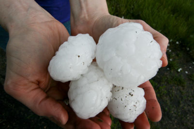
What a strange weather day. This is more typical of something in April or more likely September or October. A closed off low with tropical influences bringing flooding rain, no real wind or hail threat but a threat of low end tornadoes and a high threat for flooding. There were multiple tornado warnings. If anything touched down, my guess it was an EF-0 tornado on the ground less than a mile. I believe there were multiple funnel clouds as rotation was present, but weak and scattered. You need real instability to get those tightly wrapped couplets on radar and we just didn't have those ingredients today. We aren't done with this closed off low, but it is drifting to the east and will eventually get picked up by the jet stream and get out of here. THE GOOD NEWS - the heaviest rain is over. We will see additional rain on a scattered basis through Sunday night. NO MORE SEVERE WEATHER is expected. I am making no real changes to the forecast, but am monitoring the prospects for increased heat later in the period. Enjoy cooler than normal days through Friday!
 66
66
MEMBERS AREA

Monthly Report (including)
Thousands of WFAH Members post current weather conditions, road status reports, and pictures of weather from all over the state on the Members Facebook Page.
WHAT MEMBERS ARE SAYING ABOUT WFAH....
- Valerie: - So many times the news stations and NWS are very slow to react. Chris always lays out the potential of… Continue Reading
- Trisha: - A HUGE shout out to you for encouraging me to keep my event outside last night when everyone else was… Continue Reading
- Tony: - Wintertime forecasting is extremely difficult just like this storm coming Saturday/Sunday! (1-30/31 2021) You have to make educated guesses! I… Continue Reading
- Terry: - "I have followed Chris since he started. He is well respected throughout Indiana. He has a lot of knowledge in… Continue Reading
- Tammy - WFAH is the only weather i pay attention to. Accurate, reliable weather in an easy to understand mode. Well worth… Continue Reading
- Shirley: - I believe that I was one of the first of the members and I just don't pay any attention to… Continue Reading
- Shawn: - Chris McNew does an awesome job with this site. Always updated and real time info - except when like today… Continue Reading
- Shawn: - For weather in Indiana, the WFAH website/Facebook members group is as beneficial for 30 bucks as you can get! Chris,… Continue Reading
- Sharol: - Your amazing in your forecasts! I’ve learned so much about weather which helps me in keeping our families safe. Thank… Continue Reading
- Ron: - "I have followed Chris' weather forecasts long before he started his Weather for All Hoosiers group. I've described him to… Continue Reading
- Rick: - I just wanted to say how much I appreciate you keeping us all informed yesterday (August 24). I'm sure it… Continue Reading
- Rex: - "I see that the National Weather Service issued Excessive Heat Watches today. Like always, you beat them by a few… Continue Reading
- Pat: - "Once again, Chris is right on target with his forecast! I just noticed that the mainstream media is saying that… Continue Reading
- Nancy: - "I follow all of the TV stations as well as a few on line weather forecasters. I appreciate Chris' accuracy,… Continue Reading
- Mike’s Lawn Care: - Weather for All Hoosiers is great! Chris is always spot on and in my line of work, an accurate forecast… Continue Reading